Thad Wester
  • Home
  • School Experience
    • Research >
      • GAP Fire
      • Station Fire
      • Pea Island
      • TLS of a Forest
      • Chalk Cliffs
      • Masters Thesis
    • Terrestrial Laser Scanning >
      • USS North Carolina
      • Schooner Virginia
      • Debris Basins
      • Point Cloud Modeling
  • Contact Information
  • Blog

Taken Delivery of Phantom 2 UAV

6/18/2014

1 Comment

 
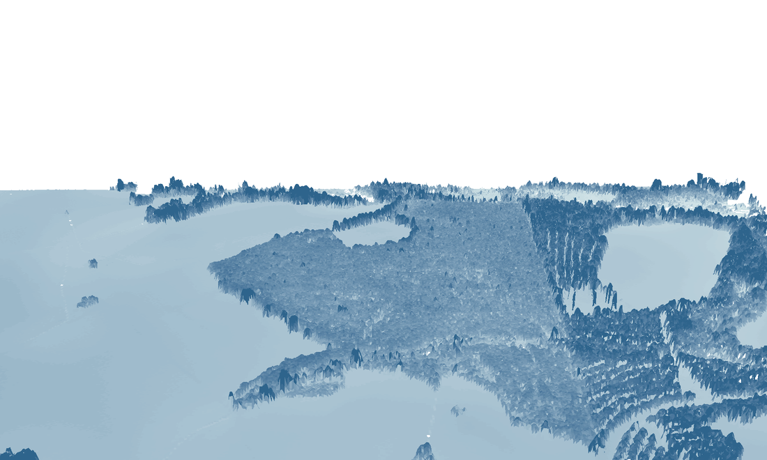
Wanted to share/store my thoughts on why we bought a UAV (drone, quad-copter whichever you call it), and what we are looking to get out of the experience.

Picture
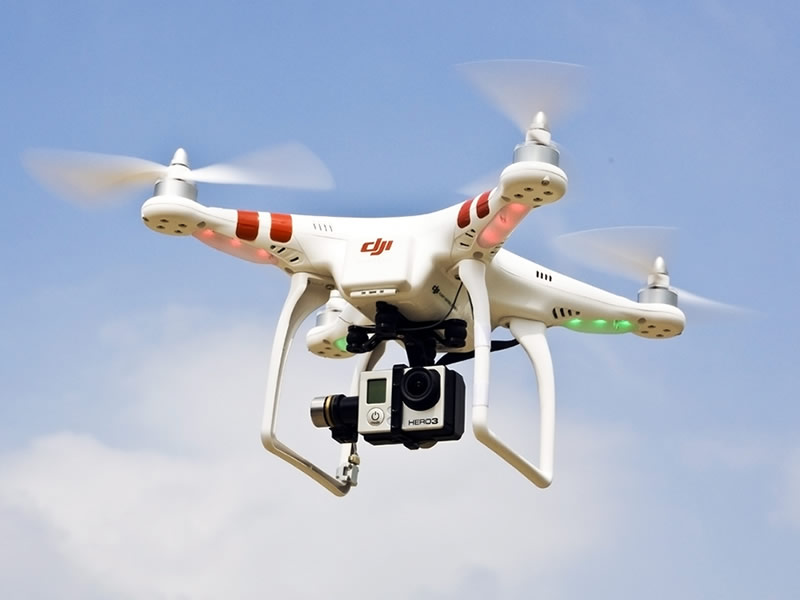
From: http://www.modellhobby.de/k_staufenb_e/prodpic/DJI-Phantom-2-RTF-with-Zenmuse-H3-3D-GoPro-3-Gimbal-2300015_b_3.JPG

Read More
1 Comment

Using aerial LiDAR to defend an accusation of property damage

5/30/2014

4 Comments

 
A colleague of mine is being accused of damaging an adjacent residential property when a pipe busted in his storage shed on the rear of his property, during a winter storm earlier this year.  The busted pipe released approx. 1 quart/min. of water onto the ground.

The question is: does water flow towards the adjacent property?  We can answer this quickly with LiDAR.
Picture

Read More
4 Comments

Calculating NDVI in ArcGIS 10

5/30/2012

16 Comments

 
Have been working on developing building footprints from aerial imagery and LiDAR data that required an NDVI calculation and wanted to share the best workflow that I have found.  You can read more about what a Normlized Difference Vegetation Index (NDVI) is here.  
Picture
Picture
Color aerial photo (left) and NDVI calculation (right).  Notice how roofs, roads and vegetation are well defined in the NDVI image. 

Read More
16 Comments

Some Press: LiDAR News

4/16/2012

2 Comments

 
Picture
I am excited to announce that I have been asked to join LiDAR News as a Distinguished Contributor.

LiDAR News is one of the largest information points for laser scanning on the internet and the only dedicated laser scanning print publication.  I was asked to begin contributing content a few weeks ago and had my first article published online yesterday.  The article will also be published in the LiDAR News print publication next month.

2 Comments

Mapping Attainable Bitrates for Rural Telcommunication

4/10/2012

0 Comments

 
Picture
Map of attainable bandwidth
Today bandwidth is King.

An increasing number of services ride on the all-encompassing internet connection.  This has done three things to the rural telecommunication business:


Read More
0 Comments

Dunes of Bald Head Island

12/6/2011

0 Comments

 
Picture
"The Point," BHI, NC
I was approached by a resident of Bald Head Island, North Carolina (BHI) and questioned about the different dune ridges that span the island, and in particular the dune ridge than runs beneath their house. So I mapped the island to determine the location of the dune ridge and possibly shine some light on their history.  I have a background in Geomorphology (the study of how landscapes change), so I also provided some information regarding the processes that have worked (and are still working) to shape BHI. 


Read More
0 Comments

Forestry GIS Advertisement

11/29/2011

0 Comments

 
Picture
LIDAR derived 3D estimation of tree height.
I put together a poster advertisement, displaying a few of the analyses I could do for practicing foresters in the region.  Forestry is inherently geographic, so it wasn't difficult to "dream-up" some examples. Some of the examples are basic (imagery) while others are more advanced (tree height, visualizations). 


Read More
0 Comments

Custom Cell Coverage Base Map - The Easy Way

11/23/2011

8 Comments

 
Picture
Cell Coverage in the United States.
High resolution cell coverage data is envied by businesses all over the country.  Unfortunately, providers and cell tower owners keep a tight leash on cell coverage information.
Recently, I was asked by a telecom company to produce a cell coverage base map where they could overlay their assets and customers; helping them to quantify their need for, and best locations of new cell tower construction within their service area.


Read More
8 Comments


    Thad Wester

    Founder @ Clarity Scanning.  Lead the WeWork Reality Capture team.  Likes tennis, ping pong and college football.

    Categories

    All
    Consulting
    Field Work
    Geomorphology
    Gis
    Introduction
    Misc
    Telecommunication
    Terrestrial Laser Scanning
    Tutorials

    View my profile on LinkedIn
Powered by Create your own unique website with customizable templates.