A colleague of mine is being accused of damaging an adjacent residential property when a pipe busted in his storage shed on the rear of his property, during a winter storm earlier this year. The busted pipe released approx. 1 quart/min. of water onto the ground.
The question is: does water flow towards the adjacent property? We can answer this quickly with LiDAR.
The question is: does water flow towards the adjacent property? We can answer this quickly with LiDAR.
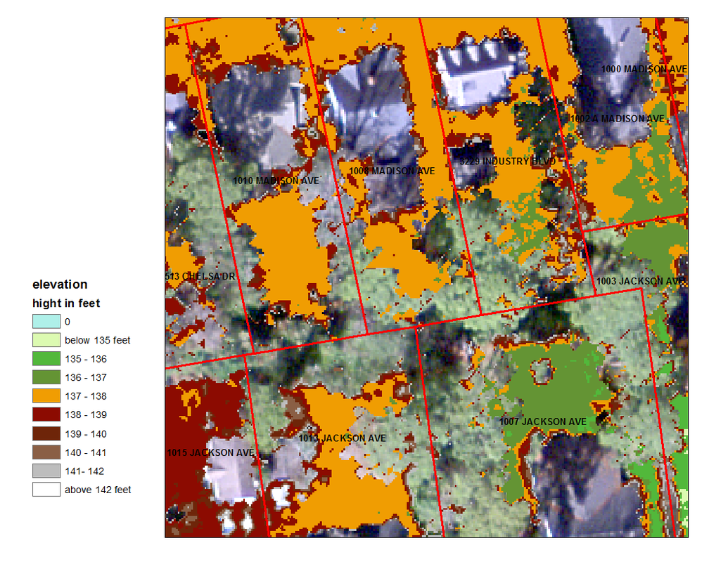
The above image shows ground elevations - and in fact does show that water would flow towards the damaged building (siding with the accuser). However, my colleague happens to be a smart engineer and was able to make this assumption from my LiDAR elevation map.
"What that tells me that not only my property but several properties are higher than his because he is lower in the watershed area, so every time it rains several properties contribute to runoff. I calculated that 1”/hr. rainfall gives 600% more runoff than a broken pipe that is flowing at 1 quart/min. We have had storms 2-3 times bigger than that (July 27, 2013). In my calculations, I assumed conservatively that the Jackson Avenue properties above him (there are 3) are the watershed area that causes runoff on his property. If I add the properties on Madison Avenue (there are 5-6) the runoff from 1”/hr. storm is much more than 600%. His problem is old and relates to poor grading for slab-on-grade shed."
Without Aerial LiDAR, you might have to hire a surveyor... Who then may need access to the accusers property... Which he may or may not get. The information in Aerial LiDAR saved $1,000's and probably a 100 hours worth of worrying and work.

