Thad Wester
  • Home
  • School Experience
    • Research >
      • GAP Fire
      • Station Fire
      • Pea Island
      • TLS of a Forest
      • Chalk Cliffs
      • Masters Thesis
    • Terrestrial Laser Scanning >
      • USS North Carolina
      • Schooner Virginia
      • Debris Basins
      • Point Cloud Modeling
  • Contact Information
  • Blog

Dunes of Bald Head Island

12/6/2011

0 Comments

 
Picture
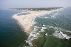
"The Point," BHI, NC
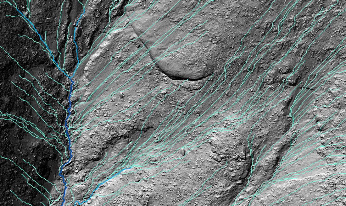
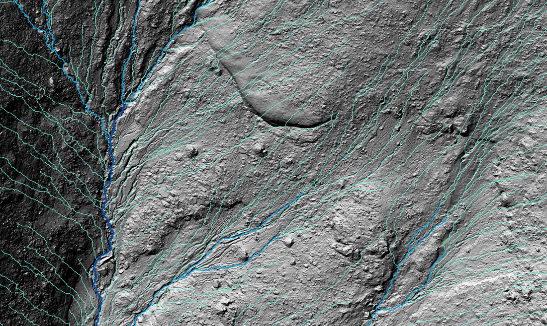
I was approached by a resident of Bald Head Island, North Carolina (BHI) and questioned about the different dune ridges that span the island, and in particular the dune ridge than runs beneath their house. So I mapped the island to determine the location of the dune ridge and possibly shine some light on their history.  I have a background in Geomorphology (the study of how landscapes change), so I also provided some information regarding the processes that have worked (and are still working) to shape BHI. 


Read More
0 Comments

Hydrologic Networks

3/1/2011

0 Comments

 
For my Masters Thesis I am using Terrestrial Laser Scanned surveys from the GAP fire to investigate the effects of a recent wildfire on hydrologic and sedimentologic connectivity during the first significant rain event.  Here I show examples of the captured terrain, hydrologic networks and their alteration, caused by the first significant rain event after the wildfire disturbance.

The surveys are both 1cm Digital Earth Models (DEMs).  However, computationally the grids are larger than can be handled in ArcMap, therefore the DEM was re-sampled to a resolution of 2cm so that hydrologic networks could be calculated. Mean absolute errors for x, y, and z in both surveys were less than or equal to +/- 3mm. The procedures for hydrologic flow network delineation are based on the Deterministic 8 (D8) model for flow over a 2cm DEM. The D8 method produces a single flow direction towards the steepest slope of one of eight grid cells neighboring the initial center cell (O’Callahan and Mark, 1984; Tarboton, 2003). The D8 method was chosen for its simplicity and widespread use in hydrologic terrain analysis (Kiss, 2004).

Read More
0 Comments


    Thad Wester

    Founder @ Clarity Scanning.  Lead the WeWork Reality Capture team.  Likes tennis, ping pong and college football.

    Categories

    All
    Consulting
    Field Work
    Geomorphology
    Gis
    Introduction
    Misc
    Telecommunication
    Terrestrial Laser Scanning
    Tutorials

    View my profile on LinkedIn
Powered by Create your own unique website with customizable templates.