Thad Wester
  • Home
  • School Experience
    • Research >
      • GAP Fire
      • Station Fire
      • Pea Island
      • TLS of a Forest
      • Chalk Cliffs
      • Masters Thesis
    • Terrestrial Laser Scanning >
      • USS North Carolina
      • Schooner Virginia
      • Debris Basins
      • Point Cloud Modeling
  • Contact Information
  • Blog

Calculating NDVI in ArcGIS 10

5/30/2012

16 Comments

 
Have been working on developing building footprints from aerial imagery and LiDAR data that required an NDVI calculation and wanted to share the best workflow that I have found.  You can read more about what a Normlized Difference Vegetation Index (NDVI) is here.  
Picture
Picture
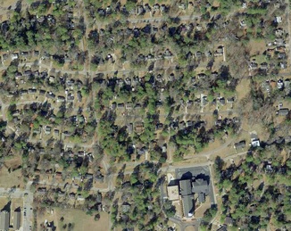
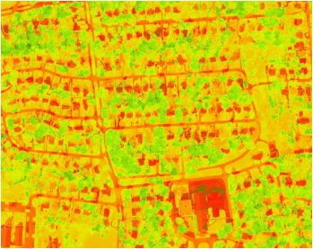
Color aerial photo (left) and NDVI calculation (right).  Notice how roofs, roads and vegetation are well defined in the NDVI image. 

Read More
16 Comments


    Thad Wester

    Founder @ Clarity Scanning.  Lead the WeWork Reality Capture team.  Likes tennis, ping pong and college football.

    Categories

    All
    Consulting
    Field Work
    Geomorphology
    Gis
    Introduction
    Misc
    Telecommunication
    Terrestrial Laser Scanning
    Tutorials

    View my profile on LinkedIn
Powered by Create your own unique website with customizable templates.