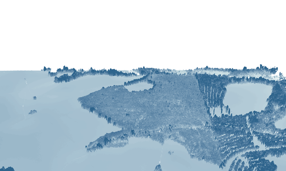
LIDAR derived 3D estimation of tree height.
I put together a poster advertisement, displaying a few of the analyses I could do for practicing foresters in the region. Forestry is inherently geographic, so it wasn't difficult to "dream-up" some examples. Some of the examples are basic (imagery) while others are more advanced (tree height, visualizations).
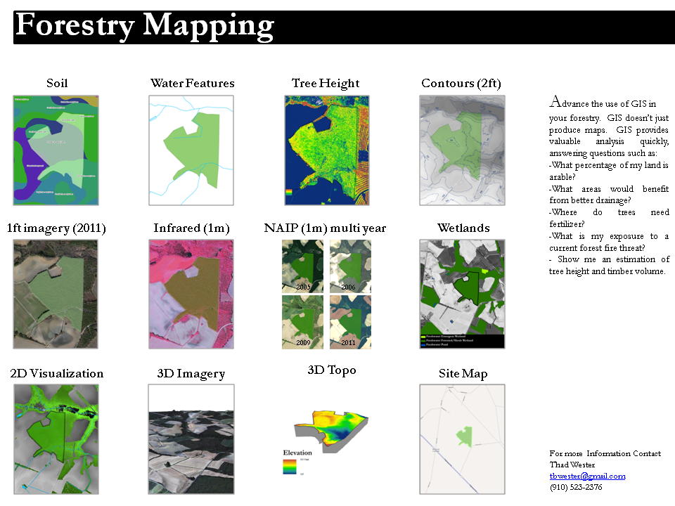
Based on my recent observations, there is significant potential, implementing GIS methods for small, local foresters. A professional GIS consultant can add value to any forestry practice, and as a bonus remove the headache of GIS analysis.

