Wanted to share/store my thoughts on why we bought a UAV (drone, quad-copter whichever you call it), and what we are looking to get out of the experience.
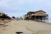
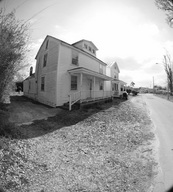
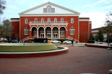
 Houses near Nags Head, NC Currently, the Outer Banks is witnessing significant rates of beach erosion, most of which is a function of sea level rise. In opposition to popular reporting, sea level rise and fall are a natural phenomenon which have been continuing for millennia. Currently we are in a period of sea level rise (Riggs and Ames 2003), the rate of which (most scientist agree) has been increased by human influenced global climate change (Gornitz et al. 1982). On the Outer Banks the effects of sea level rise are compounded by land subsidence from glacial isostatic adjustment. In fact, due to the local influence of land subsidence the Outer Banks could be experiencing a 60% greater rate of relative sea level rise in comparison to the national average of the United States (Cabanes et al. 2001). In March, 2011, I traveled to the Pea Island national wildlife refuge to terrestrial laser survey a section of overwashed dune in an attempt to establish a long term overwash monitoring site within the Cape Hatteras National Seashore. As I have detailed previously, overwash is an important aspect of barrier island landward migration and thus an important area of research along the Outer Banks, which is a barrier island. This is especially true if you also consider the amount state owned infrastructure and privately owned houses which are currently impacted or have the potential to be soon impacted by barrier island landward migration.  On 3/25/2011 I traveled to New Bern, North Carolina to terrestrial laser scan a historic house. The house, which was thought to have been built circa ~1900, is one of the few houses which survived a 1922 fire which devastated African American neighborhoods in New Bern causing over 2 million dollars in damage. Our terrestrial laser scan survey provided field measurements for modeling of the house and visualization back to its original state (vinyl siding and other alterations have been made over the years). This model and the laser scan survey will serve as the visual corner stone for the planned "trail of flames" website, which promotes a historic tour of burned areas from the 1922 fire in New Bern.  The Wright Building A long term goal of the Terrain Analysis Lab at ECU is to Terrestrial Laser Scan building or structures on East Carolina's campus that are both historically significant and recognizable landmarks, commonly associated with the image of East Carolina University's campus. Additionally, students enrolled in the Geography departments Terrestrial Laser Scanning graduate and undergraduate course were invited to assist, so that they could have hands on experience with the laser scanner in a real world environment. To satisfy these goals we chose to scan the Wright Building, located in the center of East Carolina University's campus. The Wright building was built in 1925, and along with the Cupola, is an iconic architectural structure on campus. |
|

