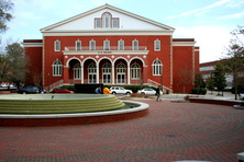
The Wright Building
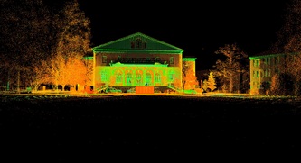
A long term goal of the Terrain Analysis Lab at ECU is to Terrestrial Laser Scan building or structures on East Carolina's campus that are both historically significant and recognizable landmarks, commonly associated with the image of East Carolina University's campus. Additionally, students enrolled in the Geography departments Terrestrial Laser Scanning graduate and undergraduate course were invited to assist, so that they could have hands on experience with the laser scanner in a real world environment. To satisfy these goals we chose to scan the Wright Building, located in the center of East Carolina University's campus. The Wright building was built in 1925, and along with the Cupola, is an iconic architectural structure on campus.
Scanning Details / Issues
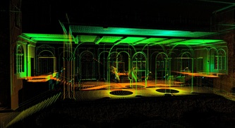
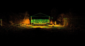
The goal of this survey was to capture the front outside structure, porch and the front entrance foyer using a terrestrial laser scanner. Once scanned, an animated fly-through of the building will be created and the building will be modeled in Cyclone 7.1.
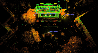
A single Leica Geosystems C10 laser scanner was employed to record points in 9 separate locations requiring ~4 hours. High resolution imagery was also recorded at each of the 9 scanning locations via a Nodal Ninja panoramic bracketed camera mount equipped with a Canon 5D/Sigma 3.5/f 8mm fish eye lens. Scanning resolutions varied between three and five centimeters at a distance of 22 meters. Registration error between the 9 surveys was 0.004 meters.
We did encountered some issues with the C10. The temperature outside was ~40 degrees Fahrenheit which forced the scanner into its "fail state" mode, basically meaning it was too cold to work. We were fortunate for two reason though, 1) we were able to make 2-3 scans outside before the scanner would go into fail state; 2) we were able to alternate working inside and outside, which allowed the scanner time to warm up before another round of outside scanning. This is the second time we have run into the fail state error, but we have been slow in implementing a workaround. Some interesting methods for keeping the scanner warm are out there though, Scott Ceaderleaf of Sky Bucket 3D came up with this one.
