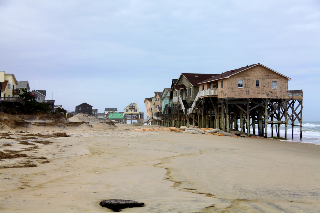
Houses near Nags Head, NC
Currently, the Outer Banks is witnessing significant rates of beach erosion, most of which is a function of sea level rise. In opposition to popular reporting, sea level rise and fall are a natural phenomenon which have been continuing for millennia. Currently we are in a period of sea level rise (Riggs and Ames 2003), the rate of which (most scientist agree) has been increased by human influenced global climate change (Gornitz et al. 1982). On the Outer Banks the effects of sea level rise are compounded by land subsidence from glacial isostatic adjustment. In fact, due to the local influence of land subsidence the Outer Banks could be experiencing a 60% greater rate of relative sea level rise in comparison to the national average of the United States (Cabanes et al. 2001).
In March, 2011, I traveled to the Pea Island national wildlife refuge to terrestrial laser survey a section of overwashed dune in an attempt to establish a long term overwash monitoring site within the Cape Hatteras National Seashore. As I have detailed previously, overwash is an important aspect of barrier island landward migration and thus an important area of research along the Outer Banks, which is a barrier island. This is especially true if you also consider the amount state owned infrastructure and privately owned houses which are currently impacted or have the potential to be soon impacted by barrier island landward migration.
In March, 2011, I traveled to the Pea Island national wildlife refuge to terrestrial laser survey a section of overwashed dune in an attempt to establish a long term overwash monitoring site within the Cape Hatteras National Seashore. As I have detailed previously, overwash is an important aspect of barrier island landward migration and thus an important area of research along the Outer Banks, which is a barrier island. This is especially true if you also consider the amount state owned infrastructure and privately owned houses which are currently impacted or have the potential to be soon impacted by barrier island landward migration.
Methods
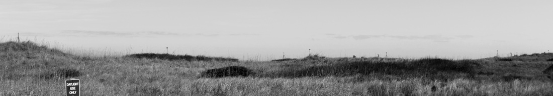
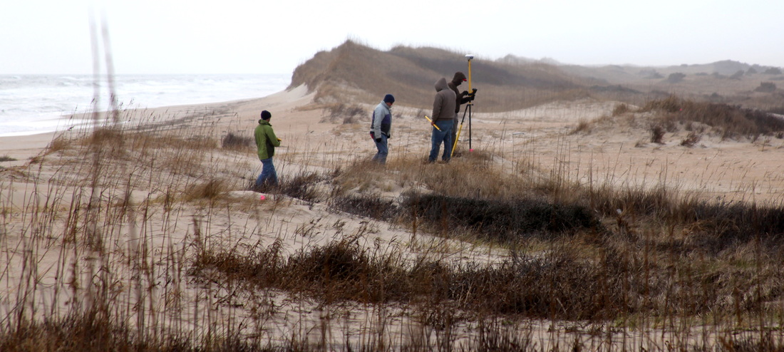
View of target and scanner setup from the behind the dune.
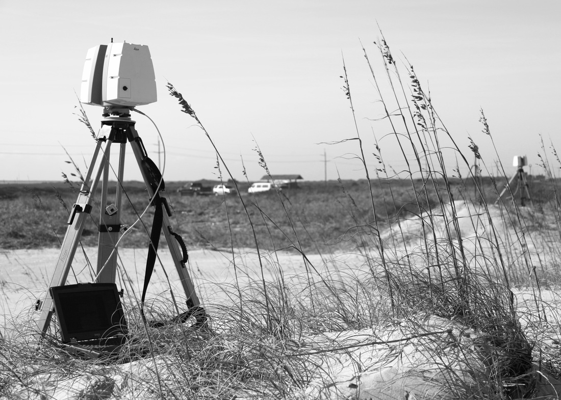
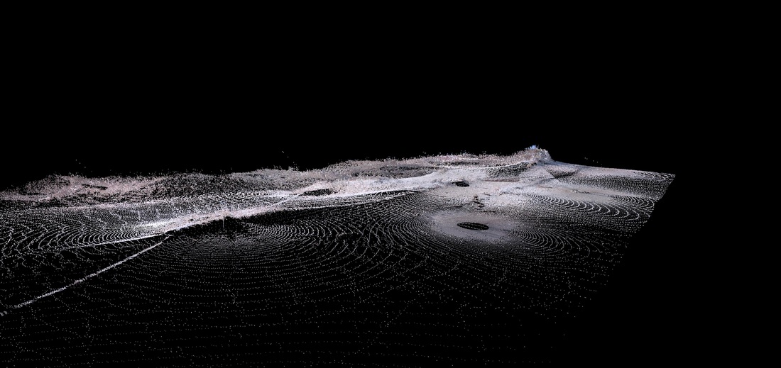
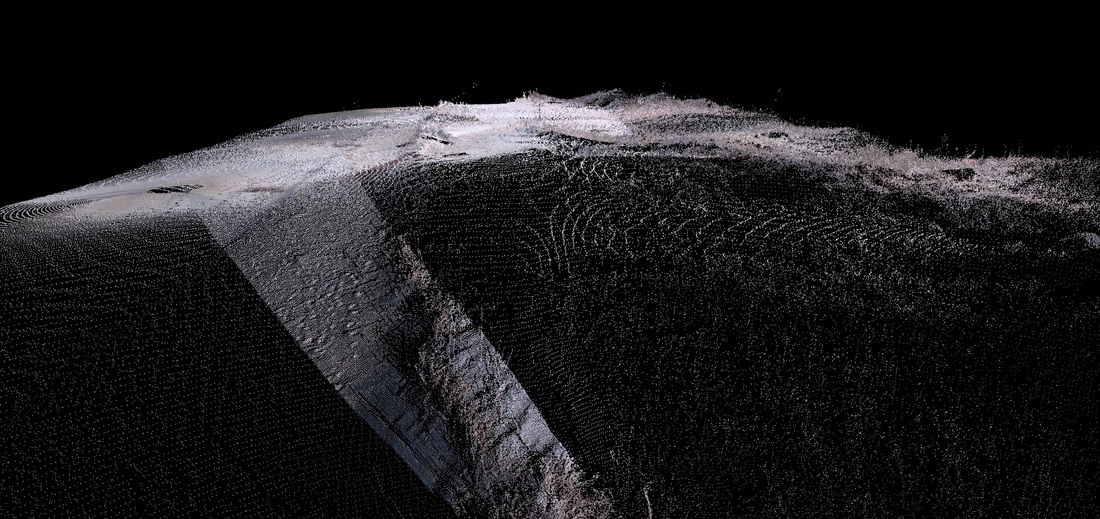
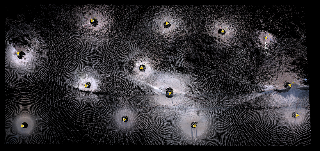
Two Leica C10 terrestrial laser scanners and eight Leica HDS targets were employed in the survey of a 150m wide stretch of overwashed dunes. 13 separate scans were made at the resolution of 2.5cm at 30m, collecting 140 million survey points in 10 hours. Registration error between the surveys was 0.002 meters. For repeat surveys at the site, 2 foot lengths of steel re-bar were driven into the ground below each of the targets, constituting target monuments.
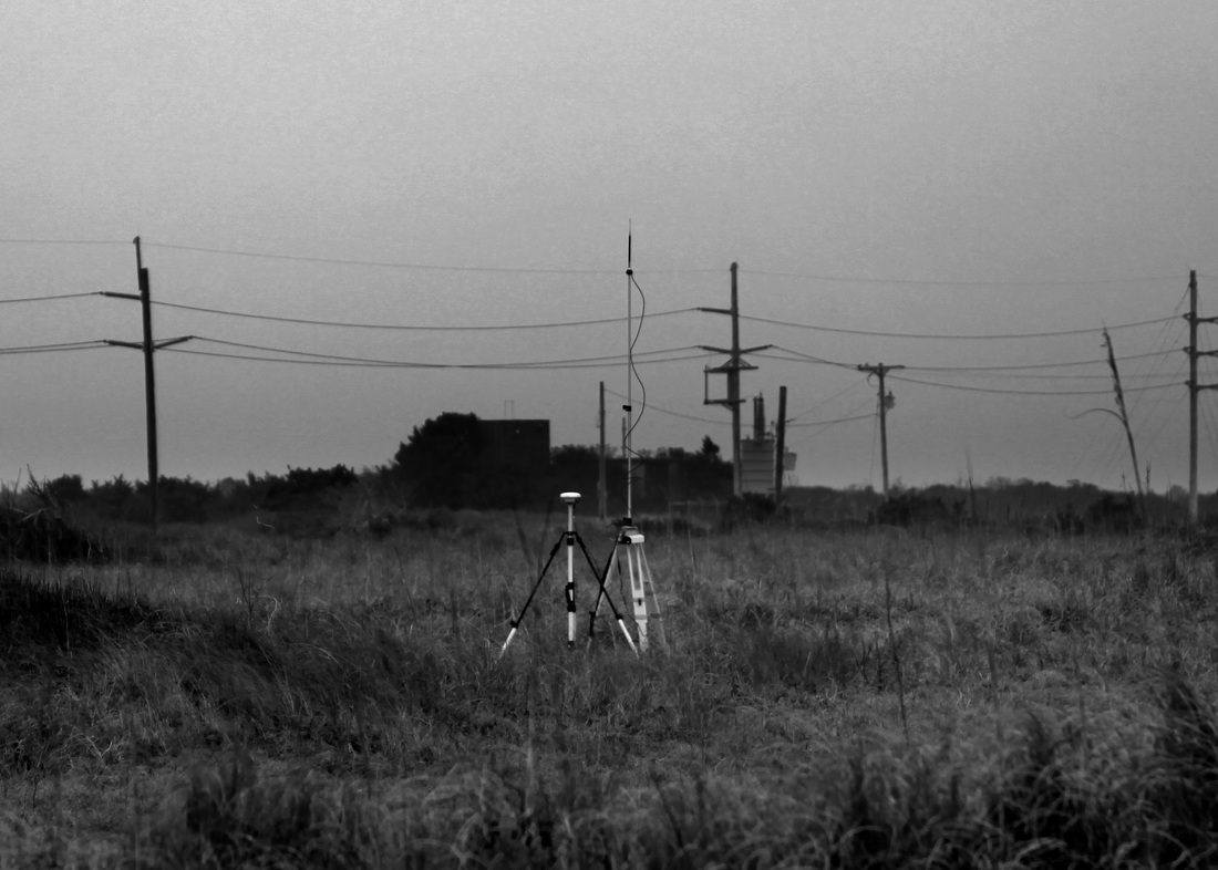
In addition to the laser scan survey, a RTK-GPS base station and rover unit provided: a coarse resolution survey of the site for comparison with laser scan data; ground-truthing in areas of dense vegetation; and geo-referencing capabilities for the laser scan survey.
In addition to the laser scan survey, a RTK-GPS base station and rover unit provided: a coarse resolution survey of the site for comparison with laser scan data; ground-truthing in areas of dense vegetation; and geo-referencing capabilities for the laser scan survey.
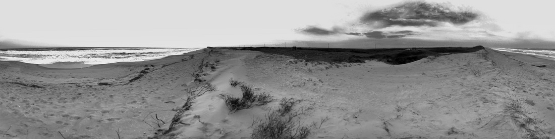
A 360 degree panorama of the study site, as viewed from the front and center of the overwashed dunes.
Discussion
Laser scanning terrain which has dense vegetation reduces the quality of data and increases post processing time greatly. Here, I am trying to solve these problems by using an RTK-GPS and a ground finding algorithm.
GPS points were surveyed in areas where the vegetation was too dense for the laser scanner to penetrate. The laser scanned vegetation points will then be replaced by the GPS points producing a more accurate digital terrain model than is possible by only using laser scanning or GPS by themselves.
Cyclone TOPO II has a ground finding function which climbs from point to point and classifies points as ground, or non-ground points (it deletes the points), based on their elevation in relation to surrounding points. A digital terrain model free of vegetation is currently being processed...
References
Cabanes et al. “Sea Level Rise During the Past 40 Years Determined from Satellite and in Situ Observations.” Science 294 (2001): 840-842.
Gornitz, V., S. Lebedeff, and J. Hansen. “Global Sea Level Trend in the Past Century.” Science 215.4540(1982): 1611-1614.
Riggs, Stanley R., and Dorothea V. Ames. Drowning the North Carolina Coast: Sea Level Rise and Estuarine Dynamics. Raleigh: North Carolina Sea Grant, 2003.

