
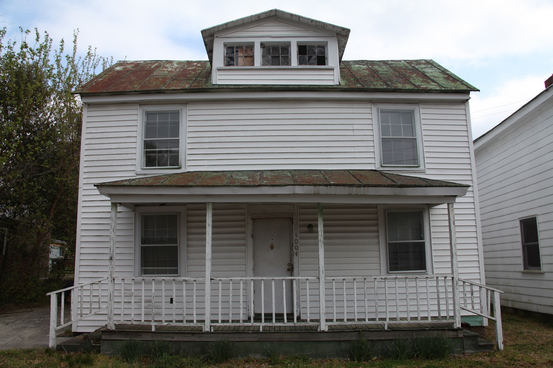
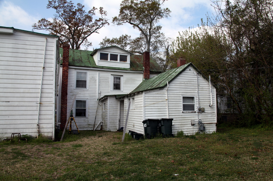
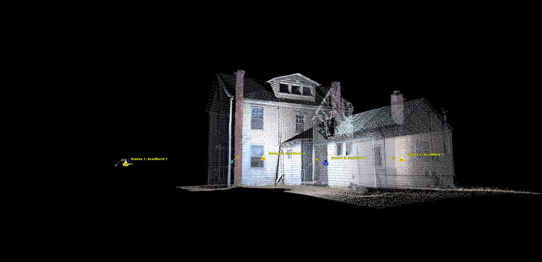
On 3/25/2011 I traveled to New Bern, North Carolina to terrestrial laser scan a historic house. The house, which was thought to have been built circa ~1900, is one of the few houses which survived a 1922 fire which devastated African American neighborhoods in New Bern causing over 2 million dollars in damage.
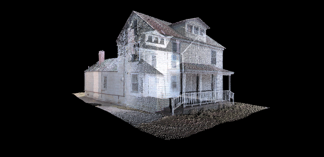
Our terrestrial laser scan survey provided field measurements for modeling of the house and visualization back to its original state (vinyl siding and other alterations have been made over the years). This model and the laser scan survey will serve as the visual corner stone for the planned "trail of flames" website, which promotes a historic tour of burned areas from the 1922 fire in New Bern.
Our terrestrial laser scan survey provided field measurements for modeling of the house and visualization back to its original state (vinyl siding and other alterations have been made over the years). This model and the laser scan survey will serve as the visual corner stone for the planned "trail of flames" website, which promotes a historic tour of burned areas from the 1922 fire in New Bern.
Methods
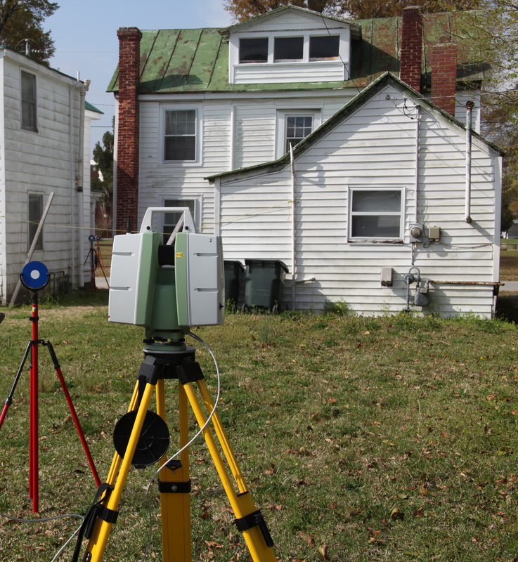
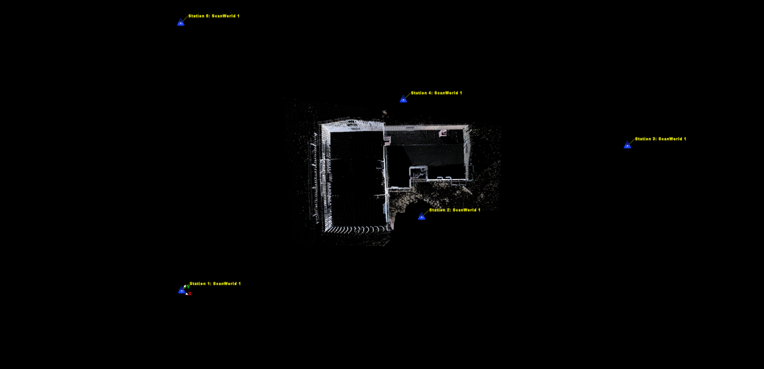
To appropriately capture the house, a single Leica C10 laser scanner was employed over five separate scan positions at the resolution of 5cm at 20 meters distance. Five targets were used for registration, providing 0.003 meters of registration error between the five surveys. Additionally, a panoramic camera setup provided three QTVR images to be used in addition, but separately from the terrestrial laser scan data.
This panorama comprises a series of photographs taken over a short period of time; technically known as Quick Time Virtual Reality or QTVR. Click and drag your mouse over the image to move your view in any direction.

