Photo: Tammy Pelletier, WA State Dept of Ecology
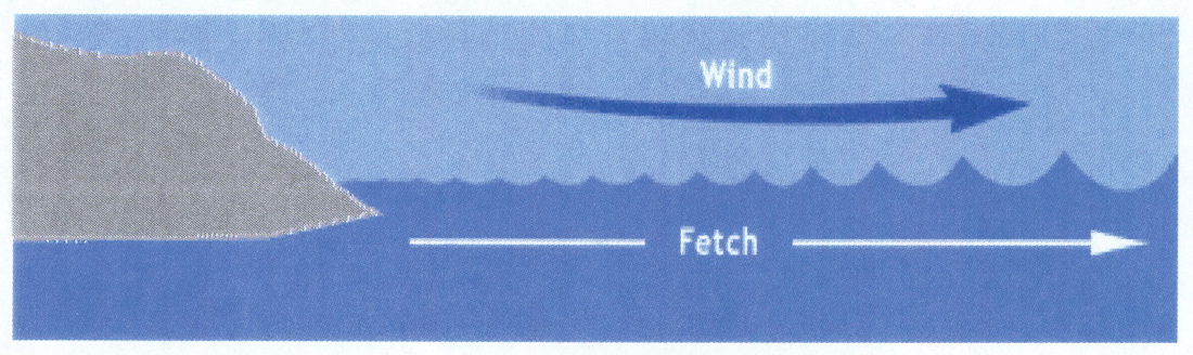
Water waves are formed by wind blowing over the surface of water. Wave height is dependent on: Wind speed, fetch (distance of water on which it is blowing), wind duration and water depth. In coastal bodies of water, wind waves, especially those associated with storms, can be unpredictable and pose hazards for recreational persons on the water in the short term and present long term erosional hazards to developed areas along the coast.
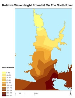
Wemo is GIS tools which uses wind, depth and fetch data to map wave height potential in areas of contained water (i.e. lakes, bays, creeks). Wemo’s output can be used to assess shoreline erosion potential, and predict areas of dangerous wave heights during specific storm conditions.
Wemo is GIS tools which uses wind, depth and fetch data to map wave height potential in areas of contained water (i.e. lakes, bays, creeks). Wemo’s output can be used to assess shoreline erosion potential, and predict areas of dangerous wave heights during specific storm conditions.
I'll keep my analysis to a minimum but think of using this information as a...
Real-estate developer, helping you to determine the most stable areas for construction, where shoreline erosion is at a minimum.
Barge captain, giving you advanced notice of the location of large waves which have the potential to wet your cargo.
Local coast guard, identifying potentially dangerous areas for recreational boaters.

