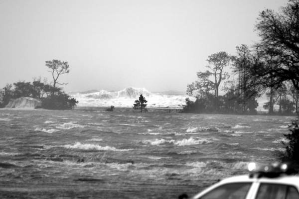
Storm surge during Hurricane Ivan (Photo: Chris Duval)
The greatest potential for loss of life related a hurricane is from it's storm surge. For emergency managers, identifying what areas have the greatest vulnerability to storm surge is paramount for the mitigation of storm surge hazards. SLOSH is a GIS tool which the National Hurricane Center uses to estimate storm surge heights.
In this example, I have estimated and mapped the number of potentially inundated census block groups during the event of a Category 3 hurricane landfall in Brunswick County, North Carolina.
In this example, I have estimated and mapped the number of potentially inundated census block groups during the event of a Category 3 hurricane landfall in Brunswick County, North Carolina.
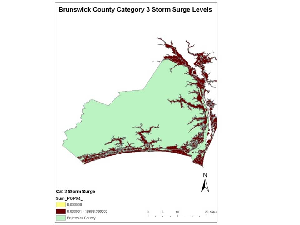
Population within Category 3 inundation zone - As of 2004 the population with the potentially inundated block groups is 16,893.
Number of housing units within Category 3 Inundation zone - As of 2004, 27,017.
Number of housing units within Category 3 Inundation zone - As of 2004, 27,017.
Discussion
The above storm surge estimation gives a usable approximation of the effected populations during the event of a Category 3 hurricane landfall in Brunswick County, North Carolina. However, the SLOSH model does not account for tide, wave height or building height, all of which are significant factors in storm surge hazard. Additionally, reanalysis of SLOSH has revealed a 20% error in magnitude of observed surge. Understanding these limitations in addition to the general uncertainty associated with hurricane path estimation, makes SLOSH primarily useful as a tool for preparedness planning.

